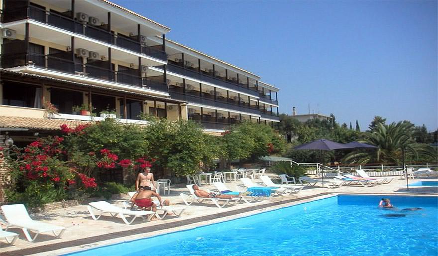
Perched above the Ionian Sea in the village of Benitses, Corfu Maris Bellos Hotel offers a tranquil retreat with panoramic views, a private beach, and a range of amenities. However, guest experiences vary, with some highlighting its strengths and others pointing out areas for improvement.
🏨 Hotel Overview
Location: Approximately 15 km from Corfu Town, accessible via a 20-minute walk or a short bus ride.
Facilities:
Outdoor pool with sun loungers
Private shingle beach
Indoor pool and spa services
Tennis court (currently not in use)
Restaurant offering Mediterranean cuisine
Bar with evening entertainment
Room Features:
Sea-view balconies
Air conditioning
Free Wi-Fi in public areas
Daily housekeeping
🧳 Guest Reviews
Guests appreciate the hotel’s location, offering stunning sea views and a peaceful atmosphere.
The staff is often described as friendly and accommodating.
The outdoor pool and beach area are noted for their cleanliness and comfort.
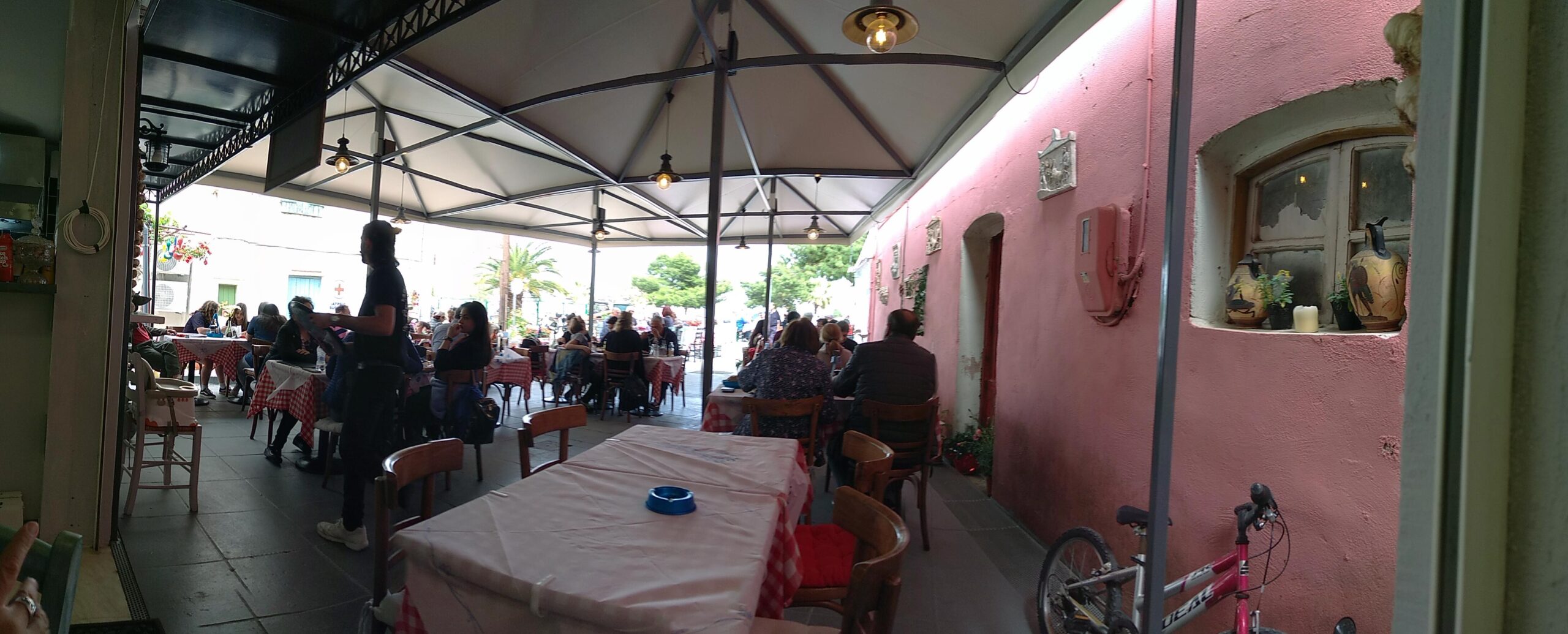
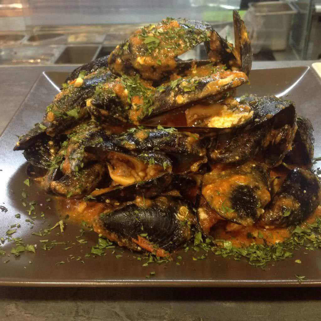
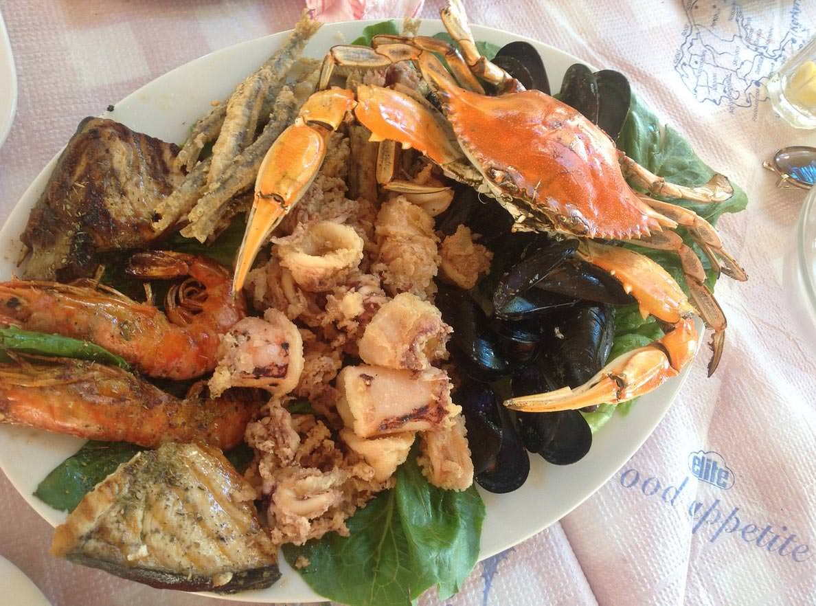
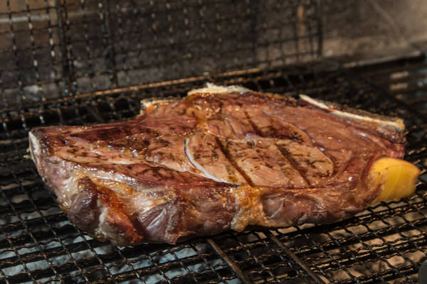
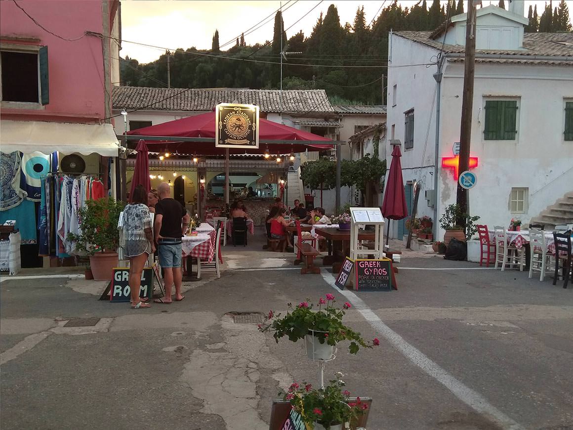
The story begins in 1935, when Grandfather Antonis, a renowned fisherman in the Benitses area, decided to open his restaurant, Kafe, to invite his friends to enjoy fresh fish and a variety of mezedes prepared by his wife, Granny Aspasia, an exceptional cook.
That is how the magical journey began and continues to this day with the third generation of the current Captain Octopus.
The Philosophy of the Captain is to cook the same way his grandparents did.
The main ingredient of the captain’s kitchen is virgin olive oil and pure spices, all carefully selected with love.
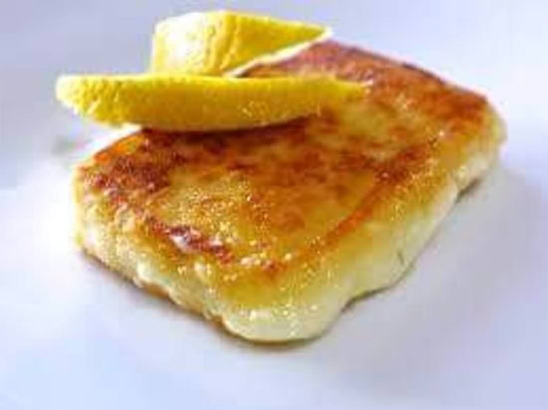
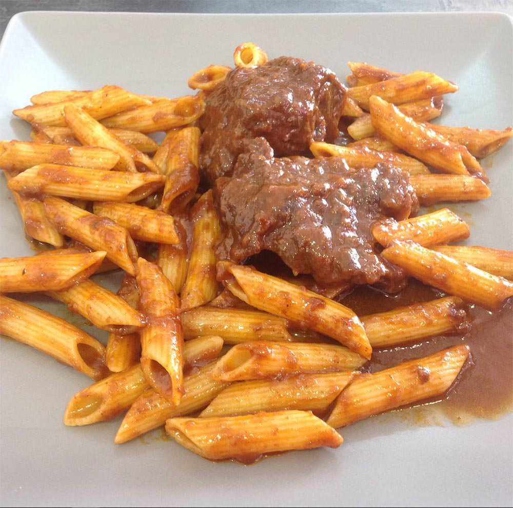
In our Traditional Corfu-flavored cuisine, the lovely Pastitsada with octopus or beef cheeks is always freshly cooked in our saucepans.
Fish, either wild or farmed, are always carefully selected with criteria for the best quality.
Squid is crispy and soft as the culinary laws stipulate, to accompany the ouzo or the local wine that the captain makes for his guests each year.
The Family Atmosphere is characteristic of Captain Octopus because there are no clients but guests in his home.
The good Greek music and even the dancing are basic components of the atmosphere of the restaurant.
The guests at Captain Octopus Taverna are invited to feel the Greek flavors on their palate and to get to know the Greek hospitality and culture for which the Captain feels proud.
Newspaper of 1864 about the Union of the Ionian Islands
On the 21st of May 1864, the British ruled Corfu and together with all the Ionian Islands, following the London Agreement and the Ionian Parliament’s resolution, united with Greece.
In fact, it was a gift of the British crown to the new King of Greece George A ‘.
The London Agreement was made in accordance with the requirements of British diplomacy and the agreement of the then-great powers, while Greece did not even participate in the talks.
And the vote in the Ionian Parliament was more symbolic than essential, the decision was taken.
The Agreement for the delivery of the Ionian Islands provided some very severe conditions for Greece, which undertook and agreed to pay any compensation to foreign governments, companies, and individuals.
There were also disagreements and unrest because of the fear that the Ionian Islands would lose their good financial position by joining a poor state.
The opposition of many of the Eptansians to the Union was well known, especially in Kefalonia and some Corfu villages.
It was one of the most important turning points in the history of Corfu, the turbulent historical past of the island ended, so ends the prominence of Corfu as the capital of the Ionian state.
Shield commemorating 50 years of Union
The consequences
Since then the historical course of Corfu and the Ionian islands is common with Greece.
The newly established Greek state could not afford the existence of two centers of economic and cultural strength, so in the battle with Athens Corfu lost and after just 40 years became a Greek provincial town.
This was done by removing from the islands many important infrastructures, such as the power plants of Corfu transferred to Piraeus, the closure of the Ionian University, the abolition of the Ionian Parliament along with the degradation of its building, important changes in the prosperous banking system of the Ionian islands and many more.
In conclusion and after a few years it was obvious that the union was disastrous, especially for Corfu, which from a thriving former capital became one of the poorest and most neglected areas of Greece.
The modern times
It was much later in the 20th century when, due to the natural beauty, the fertile soil, the rich cultural heritage, and the energy of the Corfiots, the island recovered initially with a flourishing of the local industry based on agricultural and livestock products and later with the booming of the tourism industry.
Today, although in the midst of the economic crisis unfairly and maliciously imposed on Greece, Corfu is always, at least financially, a step above the rest of Greece.
The island’s economy is now almost entirely based on tourism, but the island has great potential to support its economy in other areas too. Its rich soil and resources are more than enough to support any other economic activity.
Corfu has always retained its unique identity, this helped the memories of the past to remain and strengthen, and they are the ones that make Corfu unique, a Greek island that does not look like the others.
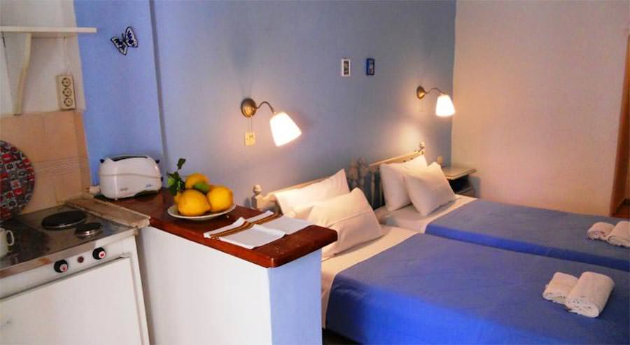
Villa Martha is a charming retreat in Benitses, perfect for couples or small families seeking comfort and a peaceful setting. The apartments are spacious, clean, and well-equipped, with kitchenettes for light meals and balconies offering lovely mountain or garden views.
Highlights:
Immaculately clean rooms with daily housekeeping.
Warm, welcoming hosts who go the extra mile, offering homemade treats like jam, cakes, and fresh fruit.
Quiet location just a short walk to the village center, restaurants, and the beach.
Convenient parking and easy access to public transport for exploring Corfu.
Cozy, comfortable spaces with essential amenities, including tea/coffee facilities and air conditioning.
Guests consistently praise the personal touches from Martha and Dimitri, noting that their kindness and attention to detail make the stay extra special. Whether you’re enjoying a morning coffee on the balcony or returning from a day on the beach, Villa Martha combines a relaxing atmosphere with the charm of a family-run property.
A highly recommended choice for a memorable and authentic stay in Benitses.
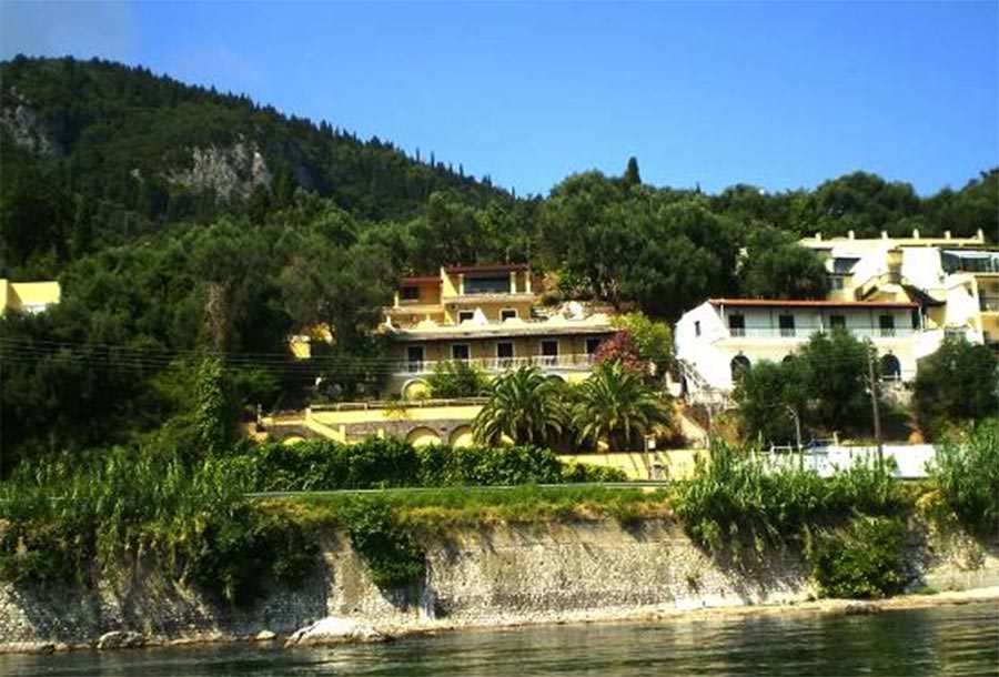
9 Muses Seaview Mansion, part of the Stellar Mediterranean Hotels group, is an adults-only property (children over 15 are welcome) located just 1 km before the picturesque village of Benitses and 13 km from Corfu Town. This charming complex offers rooms and apartments with stunning, uninterrupted views of the Ionian Sea.
Highlights:
Recently renovated accommodations with fresh, modern interiors.
All rooms and apartments are air-conditioned, feature private bathrooms with walk-in showers, flat-screen TVs, and balconies or terraces. Larger apartments include fully equipped kitchens.
Friendly, helpful staff who provide local tips, maps, and personalized assistance.
Daily housekeeping with towels and linens refreshed every three days.
Ideal for exploring Corfu by scooter or car, with easy access to Benitses, Corfu Town, and nearby beaches.
Panoramic sea views from every apartment; perfect for a relaxing, peaceful stay.
Guests frequently praise the combination of spectacular views, thoughtful service, and a tranquil location slightly removed from the town bustle. While there are several stairs within the property, the effort is rewarded with a serene and scenic retreat above the Ionian Sea.
We use cookies to offer you a top personalized experience, to help you find more easily what you are looking for, as well as to analyze our traffic. By clicking “Accept”, you consent to the use of ALL the cookies.
This website uses cookies to improve your experience while you navigate through the website. Out of these, the cookies that are categorized as necessary are stored on your browser as they are essential for the working of basic functionalities of the website. We also use third-party cookies that help us analyze and understand how you use this website. These cookies will be stored in your browser only with your consent. You also have the option to opt-out of these cookies. But opting out of some of these cookies may affect your browsing experience.
Necessary cookies are absolutely essential for the website to function properly. These cookies ensure basic functionalities and security features of the website, anonymously.
Cookie
Duration
Description
__cfduid
1 month
The cookie is used by cdn services like CloudFare to identify individual clients behind a shared IP address and apply security settings on a per-client basis. It does not correspond to any user ID in the web application and does not store any personally identifiable information.
cookielawinfo-checbox-analytics
11 months
This cookie is set by GDPR Cookie Consent plugin. The cookie is used to store the user consent for the cookies in the category "Analytics".
cookielawinfo-checbox-functional
11 months
The cookie is set by GDPR cookie consent to record the user consent for the cookies in the category "Functional".
cookielawinfo-checbox-others
11 months
This cookie is set by GDPR Cookie Consent plugin. The cookie is used to store the user consent for the cookies in the category "Other.
cookielawinfo-checkbox-advertisement
1 year
The cookie is set by GDPR cookie consent to record the user consent for the cookies in the category "Advertisement".
cookielawinfo-checkbox-necessary
11 months
This cookie is set by GDPR Cookie Consent plugin. The cookies is used to store the user consent for the cookies in the category "Necessary".
cookielawinfo-checkbox-performance
11 months
This cookie is set by GDPR Cookie Consent plugin. The cookie is used to store the user consent for the cookies in the category "Performance".
viewed_cookie_policy
11 months
The cookie is set by the GDPR Cookie Consent plugin and is used to store whether or not user has consented to the use of cookies. It does not store any personal data.
Functional cookies help to perform certain functionalities like sharing the content of the website on social media platforms, collect feedbacks, and other third-party features.
Cookie
Duration
Description
na_id
1 year 1 month
This cookie is set by Addthis.com to enable sharing of links on social media platforms like Facebook and Twitter
na_rn
1 month
This cookie is used to recognize the visitor upon re-entry. This cookie allows to collect information on user behaviour and allows sharing function provided by Addthis.com
na_sc_e
1 month
This cookie is used to recognize the visitor upon re-entry. This cookie allows to collect information on user behaviour and allows sharing function provided by Addthis.com
na_sr
1 month
This cookie is set by Addthis.com. This cookie is used for sharing of links on social media platforms.
na_srp
1 minute
This cookie is used to recognize the visitor upon re-entry. This cookie allows to collect information on user behaviour and allows sharing function provided by Addthis.com
na_tc
1 year 1 month
This cookie is set by the provider Addthis. This cookie is used for social media sharing tracking service.
ouid
1 year 1 month
The cookie is set by Addthis which enables the content of the website to be shared across different networking and social sharing websites.
Performance cookies are used to understand and analyze the key performance indexes of the website which helps in delivering a better user experience for the visitors.
Cookie
Duration
Description
d
3 months
This cookie tracks anonymous information on how visitors use the website.
YSC
session
This cookies is set by Youtube and is used to track the views of embedded videos.
Analytical cookies are used to understand how visitors interact with the website. These cookies help provide information on metrics the number of visitors, bounce rate, traffic source, etc.
Cookie
Duration
Description
__gads
1 year 24 days
This cookie is set by Google and stored under the name dounleclick.com. This cookie is used to track how many times users see a particular advert which helps in measuring the success of the campaign and calculate the revenue generated by the campaign. These cookies can only be read from the domain that it is set on so it will not track any data while browsing through another sites.
_ga
2 years
This cookie is installed by Google Analytics. The cookie is used to calculate visitor, session, campaign data and keep track of site usage for the site's analytics report. The cookies store information anonymously and assign a randomly generated number to identify unique visitors.
_gid
1 day
This cookie is installed by Google Analytics. The cookie is used to store information of how visitors use a website and helps in creating an analytics report of how the website is doing. The data collected including the number visitors, the source where they have come from, and the pages visted in an anonymous form.
Advertisement cookies are used to provide visitors with relevant ads and marketing campaigns. These cookies track visitors across websites and collect information to provide customized ads.
Cookie
Duration
Description
_pxhd
1 year
This cookie is used by the Zoominfo. This cookie collects information on user behaviour on multiple websites. This information is used inorder to optimize the relevance of advertisements.
CMID
1 year
The cookie is set by CasaleMedia. The cookie is used to collect information about the usage behavior for targeted advertising.
CMPRO
3 months
This cookie is set by Casalemedia and is used for targeted advertisement purposes.
CMPS
3 months
This cookie is set by Casalemedia and is used for targeted advertisement purposes.
CMRUM3
1 year
This cookie is set by Casalemedia and is used for targeted advertisement purposes.
CMST
1 day
The cookie is set by CasaleMedia. The cookie is used to collect information about the usage behavior for targeted advertising.
DSID
1 hour
This cookie is setup by doubleclick.net. This cookie is used by Google to make advertising more engaging to users and are stored under doubleclick.net. It contains an encrypted unique ID.
id
1 year 1 month
The main purpose of this cookie is targeting and advertising. It is used to create a profile of the user's interest and to show relevant ads on their site. This Cookie is set by DoubleClick which is owned by Google.
IDE
1 year 24 days
Used by Google DoubleClick and stores information about how the user uses the website and any other advertisement before visiting the website. This is used to present users with ads that are relevant to them according to the user profile.
KADUSERCOOKIE
3 months
The cookie is set by pubmatic.com for identifying the visitors' website or device from which they visit PubMatic's partners' website.
KTPCACOOKIE
1 day
This cookie is set by pubmatic.com for the purpose of checking if third-party cookies are enabled on the user's website.
mc
1 year 1 month
This cookie is associated with Quantserve to track anonymously how a user interact with the website.
mdata
1 year 1 month
The domain of this cookie is owned by Media Innovation group. This cookie registers a unique ID used to identify a visitor on their revisit inorder to serve them targeted ads.
ov
1 year 1 month
This cookie is set by the provider mookie1.com. This cookie is used for serving the user with relevant content and advertisement.
test_cookie
15 minutes
This cookie is set by doubleclick.net. The purpose of the cookie is to determine if the user's browser supports cookies.
uid
1 year 1 month
This cookie is used to measure the number and behavior of the visitors to the website anonymously. The data includes the number of visits, average duration of the visit on the website, pages visited, etc. for the purpose of better understanding user preferences for targeted advertisments.
uuid2
3 months
This cookies is set by AppNexus. The cookies stores information that helps in distinguishing between devices and browsers. This information us used to select advertisements served by the platform and assess the performance of the advertisement and attribute payment for those advertisements.
VISITOR_INFO1_LIVE
5 months 27 days
This cookie is set by Youtube. Used to track the information of the embedded YouTube videos on a website.