Last updated on December 9th, 2020 at 01:01 pm
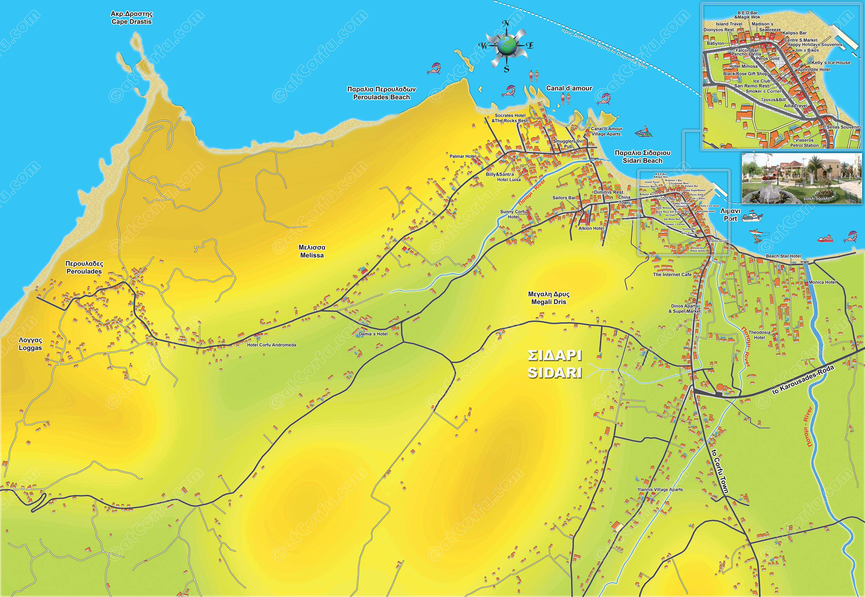
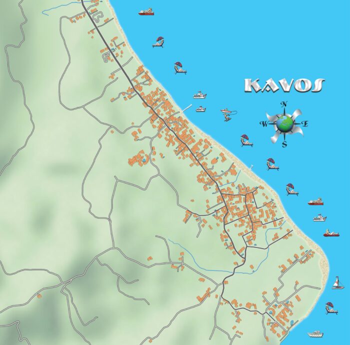
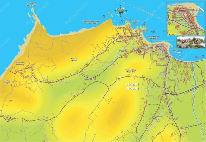
Sidari is one of Corfu’s largest tourist destinations and lies on the north and west coast of Corfu, a large tourist resort and a long stretch of golden sand ending at famous Canal d`amour.
This is a large detailed map of the Sidari wide tourist area, from an area near Roda up to Peroulades.
More Maps
Petriti and Boukari map
Map for Petriti and Boukari. These are two small fishing villages on the East coast of Corfu, about 20 miles from the town.… Read More
Sidari map
This is a large detailed map of the Sidari wide tourist area, from an area near Roda up to Peroulades.… Read More
Moraitika and Messonghi map
A map for the tourist area of Messonghi and Moraitika on the southeast side of Corfu. Some of the most touristic development villages of Corfu, with the only sandy beach of Corfu’s East seaside.… Read More
Diapontia Islands Map: Othonoi, Ereikoussa, and Mathraki
A map of Diapontia islands, Othonoi, Ereikoussa and Mathraki, along with some smaller as Diakopo, Diaplo, Karavi, Lipso, etc.… Read More
Benitses Map: Maps of Benitses Wide Area
Benitses maps in large size showing in such detail all small roads, paths, and landscape, this map of Benitses is the only one that exists in such a size.… Read More
Bilingual Corfu Greece Map with English Names
This is a new Map of Corfu island in Greece, all names in Greek and English language.… Read More
5 Corfu Maps Of High Resolution in Greek and English
Corfu maps for the island and the town of Corfu, new and updated high-resolution tourist maps with small paths, roads, and places, in Greek and English… Read More
Leave a Comment