


Last updated on June 23rd, 2025 at 09:13 pm
Map with the most known beaches of Corfu island.
In this map there are the most known small and large beaches around the coastal line of Corfu island.

See More Maps
Corfu Beaches by Region: Custom Maps of North, South & Central Coasts
Explore the best beaches by area, using custom regional maps and links to local beach guides all written from firsthand experience.

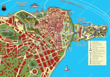
Map of the City of Corfu With the Southern Suburbs
Another map of Corfu’s wider area, including the city’s urban fabric, southern suburbs, and the Kanoni peninsula, extends up to Mouse Island.
A map of Corfu Attractions, Sights and Monuments
Corfu, with its rich history, stunning landscapes, and vibrant culture, is a treasure trove of attractions waiting to be explored.

Map With Best Corfu Beaches By Type
Explore this map of Corfu beaches, indexing each beach by type. From large sandy shores to secluded pebbly coves, and find the perfect spot for your visit.
Map with Distances and Directions from Corfu center (PDF)
On this map there are Directions to all known villages and tourist places in the island of Corfu and their distance from the center of Corfu

Map of Beaches in Corfu Island
Map with the beaches of Corfu island, the most known small and large beaches around the coastal line of Corfu island.
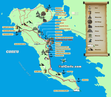
Corfu Old Town Walking Map
This is another map of Corfu old town

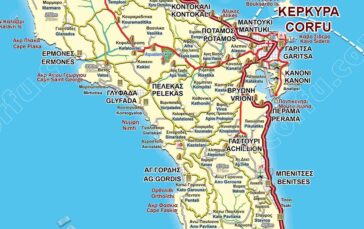
Corfu Island Large Road Map
A large road map of Corfu with all main, large, and rural roads and paths, as they are today.

A Large Map of Corfu Town
A large map of the town of Corfu with emphasis in the old part of the medieval town at the east of the peninsula.
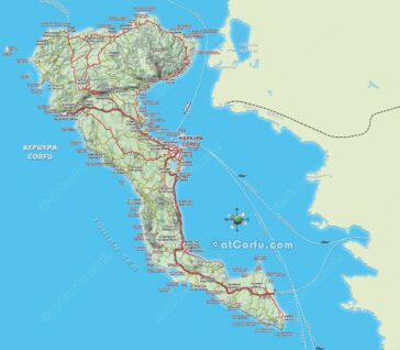
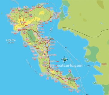
Detailed Tourist Corfu Map
A large map of Corfu island, with all details, and roads, updated every year.