Share this with your friends!
TwitterFacebookPinterest

Last updated on January 6th, 2025 at 10:45 am

Corfu maps are bilingual, in Greek and English. Updated yearly with new additions, when necessary. The last touch was in 2023.

Maps of Corfu Island

Where is Corfu

Corfu is a Greek island in the Ionian Sea, located off the northwest coast of Greece, near Albania.

It is part of the Ionian Islands group and is known for its lush landscapes, beautiful beaches, and rich cultural history influenced by Venetian, French, and British rule.

The island sits approximately 2 km (1.2 miles) from the Albanian coast at its closest point and is accessible by ferry and air, making it a popular destination for travelers.

Corfu map with all roads
Click for a large size Corfu Map

More Large Corfu maps

We created these maps to provide travelers with all the information they need to explore this island.

A Tourist Road Corfu Map Including the Larger Villages

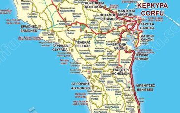
Map of Corfu island with all details, large and small roads, all places, and beaches. Always in high resolution, renewed recently.

Corfu map
Corfu map
Corfu Tourist Road Map

Geophysical Corfu Map – The Landscape of Corfu

See on this small Corfu map the landscape of Corfu, the mountainous, and the flat areas. The light brown areas are the hights.

Corfu map with mountainous and flat areas

Maps for the town of Corfu

This is a map of Corfu town with the old fortress

The maps of Corfu town were designed with an emphasis on the old city.

A medieval town that essentially formed during the Venetian rule, therefore the streets are narrow with awkward shapes, actually were and still are for pedestrians. Streets between houses that cannot fit cars.

In many places, if someone opens his hands, he can comfortably touch both walls across buildings. Here in Corfu, these paths are called Kantounia.

This added another degree of difficulty to the map design. There are streets in a triangle shape or round shape, some smaller than 50 meters. How can someone write the name in two languages for such shapes and sizes?

The only open spot in the old city seems to be the endless Esplanade Square and the area in front of the old fortress, which is rendered with an artistic mood on the map.

The main street of the old town is the street of Nikiforos Theotokis. It starts from Liston and ends at the Spilia, the harbor district at the foot of the New Fortress.

Today, all roads inside the old city are pedestrian roads. The traffic with cars is done on regional routes around the old city.

Corfu Town Map

Explore Corfu’s medieval charm in its narrow, winding “Kantounia” streets.

Amidst this labyrinth, find an oasis in Esplanade Square and the area near the ancient fortress, depicted on our map.

The star of the old town is Nikiforos Theotokis Street, a pedestrian haven from Liston to Spilia by the harbor’s New Fortress.

Discover Corfu’s history on foot, where streets carry the city’s essence, blending old-world charm with modern convenience.

Corfu town map
Corfu town map
Click for a Large Corfu Town Map

Old Corfu Town Map

Another map of Corfu’s old town, the same map with different colors

Old Corfu town map
Old Corfu town map
Another Large Corfu Town Map

Corfu Town Map with the Southern Suburbs

Another Corfu map of the wider area of the city includes all the urban fabric with the southern suburbs and the Kanoni peninsula up to Mouse Island.

Map of the City of Corfu with the southern suburbs

To open the maps at full size, right-click on the map and open in a new window or a new tab.

Interactive Corfu Map by Google

NOTE: You can download and use the maps only for personal use. Reproduction, printing for commercial exploitation, or alteration of the maps is explicitly prohibited.

On your websites, you may use them only if you provide proper credit with a visible link to the source.

More Maps

Maps of Corfu Areas and Nearby Islands

|

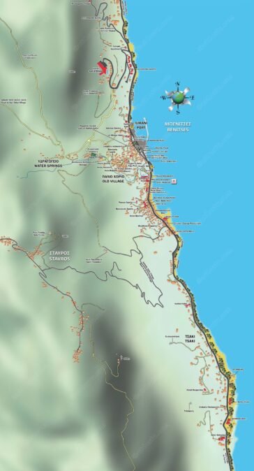
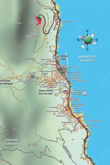
Maps of Corfu areas and close to Corfu islands. Paxos – Antipaxos, Diapontia, Sidari, Messonghi and Moraitika, Petriti-Boukari and Kavos.

Petriti and Boukari map

|

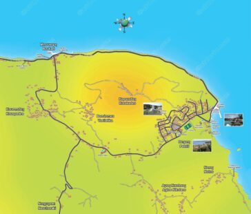
Map for Petriti and Boukari. These are two small fishing villages on the East coast of Corfu, about 20 miles from the town.

Sidari map: All the Area Up to Peroulades With Details

|

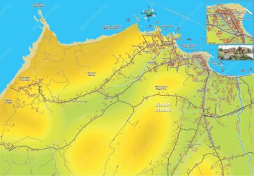
This is a large detailed map of the Sidari wide tourist area, from an area near Roda up to Peroulades.

Kavos map

|

A map of the Kavos area. The most popular tourist destination on the island among the young British tourists because of its rich and notorious nightlife

Moraitika and Messonghi map

|

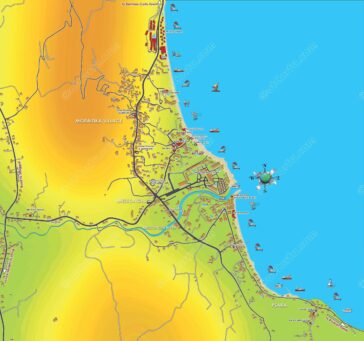
A map for the tourist area of Messonghi and Moraitika on the southeast side of Corfu. Some of the most touristic development villages of Corfu, with the only sandy beach of Corfu’s East seaside.

Diapontia Islands Map: Othonoi, Ereikoussa, and Mathraki

|

A map of Diapontia islands, Othonoi, Ereikoussa and Mathraki, along with some smaller as Diakopo, Diaplo, Karavi, Lipso, etc.

All Maps

Comments

TwitterFacebookPinterest